
 CamsAhead.com
Cameras in Minneapolis, MN
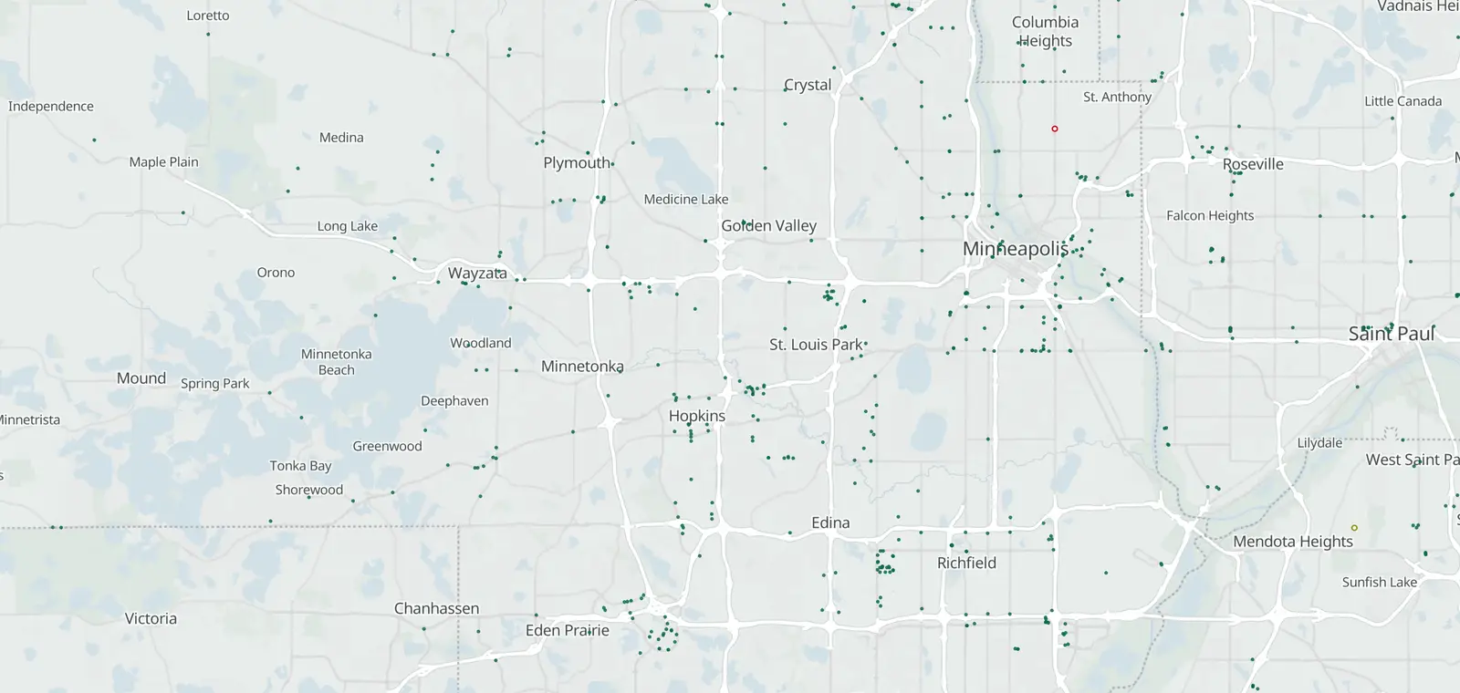
117 mapped plate readers and a speed camera program in Minneapolis.
Plate readers © OpenStreetMap contributors · © OpenMapTiles
Minneapolis, by camera type.
Minneapolis: 117 plate readers mapped. Nearby: St. Louis Park 32, Brooklyn Center 26, Edina 47 and St. Paul 61.
Speed cameras in Minneapolis
Minneapolis runs a speed camera program (running, as of Sep 2026), not yet on this map.
1 speed or red light camera is on the map, counted apart from official lists.
- Speed cameras · Running (as of Sep 2026) Public list City of Minneapolis ↗
The law, in short:
MN 2024 traffic safety camera pilot law (citation not yet confirmed).
Red light cameras in Minneapolis
State law in Minnesota allows red light cameras. None listed in Minneapolis.
License plate readers in Minneapolis
117 plate readers are on the map in Minneapolis, and 63 of them carry the Flock Safety tag. Most don't say who runs them. Minneapolis Police Department is tagged on 45.
First-mapped dates here run from Nov 13, 2024 to Oct 25, 2026. 59 of the 117 were first mapped in 2025, with 53 in November alone.
The EFF's Atlas of Surveillance lists 4 agencies based in Minneapolis that use plate readers, among them Minneapolis Police Department.
Traffic cameras in Minneapolis
No traffic camera feed is listed for Minneapolis yet.
Camera tickets in Minneapolis
Follow the instructions and the deadline on the notice.
Know when cameras in Minneapolis change.
Free email alerts for cameras on your routes that start issuing tickets. One summary email a month.
- In your monthly summary: the day a camera near you starts issuing tickets
- New cameras mapped or reported near you
- What plate readers keep, and who runs them
- Your street, your distance, the camera types you pick
156,883 cameras listed or mapped so far.
Sources and updates
How this page was made: CamsAhead writes each page type once, then fills it with this place's data from the sources below.
- City of Minneapolis: speed camera program, running, as of Sep 2026
- OpenStreetMap contributors: plate readers, speed and red light cameras, data as of Nov 7, 2026; ODbL 1.0
- EFF Atlas of Surveillance: agencies that use plate readers, data as of Aug 2026; CC BY 4.0
- US Census Bureau: city boundary (cartographic file 2025)
Plate reader points are mapped by OpenStreetMap volunteers (data as of November 7, 2026).
How CamsAhead counts cameras · Report a problem · Report a camera