
 CamsAhead.com
© OpenStreetMap contributors (ODbL) · © OpenMapTiles
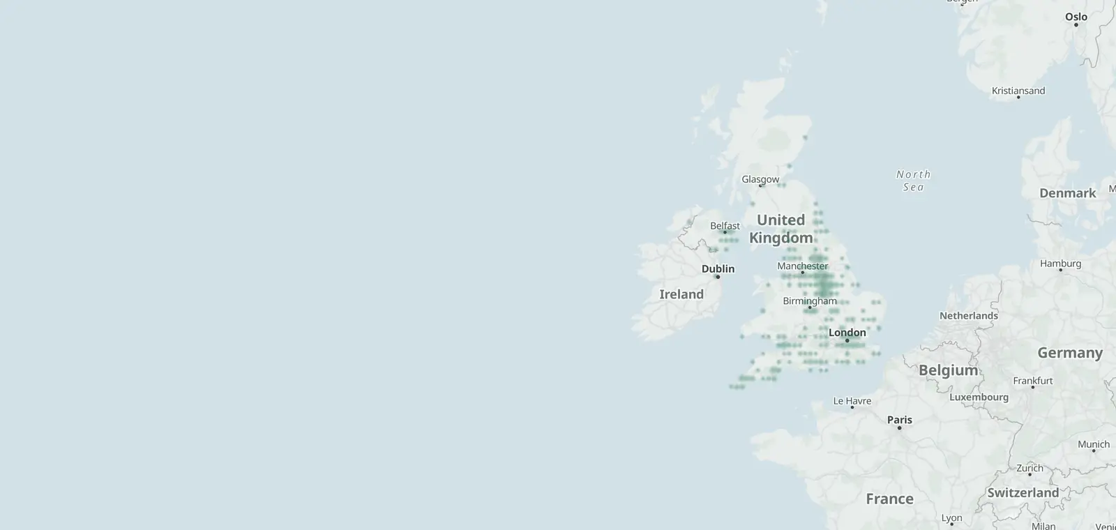
ANPR cameras read the number plate of each passing vehicle and keep the read with the time and place. 1,415 are mapped in the UK as of 7 November 2026: England 1,258, Northern Ireland 72, Wales 68 and Scotland 17. Police forces do not publish their fixed sites, so this map shows the readers mapped so far.
UK ANPR camera map
Readers close together share a dot.
Your location stays on your device.
ANPR cameras by nation
| Nation | Mapped | With a direction tag | First mapped |
|---|---|---|---|
| England | 1,258 | 1,124 | 23 April 2015 to 3 November 2026 |
| Scotland | 17 | 13 | 5 October 2021 to 17 September 2026 |
| Wales | 68 | 65 | 23 September 2019 to 25 June 2026 |
| Northern Ireland | 72 | 70 | 28 December 2022 to 24 August 2026 |
Areas with the most mapped ANPR cameras
178 local authority areas have at least one mapped reader; these 33 have 10 or more. The map shows them all.
| Area | Nation | Mapped | First mapped | Named operators |
|---|---|---|---|---|
| Leeds | England | 99 | 25 April 2019 to 16 September 2026 | Leeds City Council |
| Sheffield | England | 91 | 28 September 2021 to 6 October 2026 | Sheffield City Council |
| Nottingham | England | 71 | 13 February 2021 to 15 May 2023 | None tagged |
| Cornwall | England | 67 | 9 March 2021 to 14 September 2026 | Aldi |
| Ashfield | England | 46 | 10 February 2021 to 5 October 2026 | None tagged |
| Cardiff | Wales | 38 | 25 September 2025 to 17 March 2026 | Cardiff Council, Premier Park, Parkingeye, Smart Parking |
| Ards and North Down | Northern Ireland | 34 | 28 December 2022 to 18 September 2025 | None tagged |
| Birmingham | England | 32 | 14 January 2022 to 21 September 2026 | None tagged |
| Newark and Sherwood | England | 31 | 13 September 2021 to 1 September 2026 | None tagged |
| Bassetlaw | England | 27 | 22 September 2021 to 23 August 2023 | None tagged |
| Bolsover | England | 27 | 13 September 2021 to 15 May 2023 | None tagged |
| Rotherham | England | 25 | 28 September 2021 to 29 December 2022 | None tagged |
| Westminster | England | 22 | 6 August 2020 to 4 July 2024 | None tagged |
| Barnsley | England | 21 | 29 October 2021 to 29 October 2021 | None tagged |
| Mansfield | England | 21 | 13 September 2021 to 15 May 2023 | None tagged |
| Cheshire East | England | 20 | 22 February 2022 to 27 May 2025 | None tagged |
| Exeter | England | 20 | 7 April 2022 to 7 April 2022 | None tagged |
| Gedling | England | 19 | 23 September 2021 to 15 May 2023 | None tagged |
| Teignbridge | England | 17 | 7 April 2022 to 7 April 2022 | None tagged |
| Newry, Mourne and Down | Northern Ireland | 16 | 28 December 2022 to 28 December 2022 | None tagged |
| Rushcliffe | England | 16 | 22 September 2021 to 22 September 2024 | None tagged |
| West Northamptonshire | England | 16 | 28 December 2022 to 18 May 2026 | None tagged |
| Broxtowe | England | 15 | 24 September 2021 to 15 May 2023 | None tagged |
| North Northamptonshire | England | 15 | 16 March 2025 to 30 September 2026 | None tagged |
| Oxford | England | 15 | 7 April 2021 to 27 September 2026 | None tagged |
| Brentwood | England | 14 | 12 September 2026 to 13 September 2026 | None tagged |
| Flintshire | Wales | 14 | 31 December 2022 to 25 June 2026 | None tagged |
| North West Leicestershire | England | 14 | 13 February 2021 to 1 November 2021 | None tagged |
| Derby | England | 12 | 22 June 2021 to 15 April 2023 | NCP |
| Newham | England | 11 | 13 July 2020 to 3 April 2025 | London Borough of Newham |
| North Kesteven | England | 11 | 16 September 2021 to 16 June 2025 | None tagged |
| Erewash | England | 10 | 23 September 2021 to 23 October 2023 | None tagged |
| Lambeth | England | 10 | 23 February 2022 to 22 November 2024 | None tagged |
What an ANPR camera looks like
ANPR cameras do not share one look: the same technology reads plates at tolls, car parks and speed cameras, so many are easy to pass without noticing them. Cameras run by National Highways are easy to recognise by their bright green casing. Some add infrared lighting, which helps them capture a clear image of the plate.
What UK speed cameras look like: camera types.
How ANPR works and what it records
Records. The plate, the date and time, the camera, its location and direction, an overview image and a close-up of the plate (Home Office, National ANPR Service data protection impact assessment, version 4, January 2025).
Checked against. Lists of vehicles of interest, such as stolen, uninsured or untaxed vehicles.
The national network. The Home Office counts 12,076 camera sets and 1,878 mobile ANPR cameras sending on average over 100 million reads a day to the National ANPR Service (version 4, January 2025).
Who runs them. Police forces, councils and car-park operators. Of the 1,415 readers mapped here, 67 carry the operator's name; the rest are untagged.
Oxford's traffic filters are ANPR cameras at 6 points.
How long ANPR data is kept
| Where | How long |
|---|---|
| Police force systems | Deleted no later than 90 days after the read |
| National ANPR Service | Deleted 12 months after capture, unless kept for a case |
| Most searches | The last 90 days only |
| Longer | Up to a year with authorisation, or kept for a case |
Source: Home Office, National ANPR Service data protection impact assessment, version 4, January 2025. A private car park follows its operator's own policy under UK GDPR.
Flock cameras in the UK
6 of the 1,415 readers mapped in the UK carry a Flock Safety maker tag (7 November 2026). Flock Safety is a US maker of plate-reading cameras. The UK's police network is the National ANPR Service. In the US: Flock cameras and license plate readers.
ANPR camera questions
How long are ANPR records kept in the UK?
Police force copies are deleted no later than 90 days after the read; national records 12 months after capture unless they are kept for a case. Most staff may search only the last 90 days (Home Office, National ANPR Service data protection impact assessment, version 4, January 2025).
Can I check where ANPR cameras are?
Yes, on the map: it shows the 1,415 readers mapped so far; tap Near me for the closest. Police forces do not publish their fixed sites (RAC: “The fixed locations remain undisclosed as this information could benefit potential offenders”).
Where are ANPR cameras normally?
On motorway and A-road gantries, at zone boundaries and bus gates, at car-park entrances and in police vehicles. Of the 1,415 mapped here, 67 carry the name of who runs them, mostly councils and car-park operators.
How does an ANPR camera work?
It photographs each passing number plate, reads it as text and checks it against lists of vehicles of interest (Home Office, National ANPR Service data protection impact assessment, version 4, January 2025).
What shows up on an ANPR camera, and what does it check?
The plate, the time, the place, the direction and an image of the vehicle. The read is checked against lists of vehicles of interest, such as stolen, uninsured or untaxed vehicles.
Do ANPR cameras give tickets?
ANPR itself reads plates. A fine follows only where a scheme uses it, such as a paid car park, a bus gate, a clean air zone or an untaxed or uninsured vehicle, under that scheme's rules.
Which cameras have ANPR?
Dedicated ANPR units, average speed cameras (they read plates at each end), zone and bus-gate cameras and some car-park cameras. A plain CCTV camera does not.
Is that an ANPR van or a speed camera van?
A speed camera van measures speed; an ANPR van reads plates. Types of speed cameras in the UK shows each kind.
Can I request ANPR data, and can anyone access it?
Access is for authorised police staff for policing purposes (Home Office, National ANPR Service data protection impact assessment, version 4, January 2025). A person may ask a force for the data about their own vehicle under UK GDPR (a subject access request). There is no public search.
Are there Flock cameras in the UK?
6 of the 1,415 readers mapped in the UK carry a Flock Safety maker tag (7 November 2026). Flock Safety is a US company; a Flock camera is one maker's ANPR camera. The UK's police network is the National ANPR Service.
Sources and updates
- OpenStreetMap contributors: ANPR cameras (plate readers) in the UK, data as of 7 November 2026; ODbL 1.0
- Office for National Statistics: Local Authority Districts (May 2026) Boundaries UK BGC (generalised 20 m, clipped to the coastline), and the English regions, which place each camera. Source: Office for National Statistics licensed under the Open Government Licence v.3.0. Contains OS data © Crown copyright and database right 2026.
- Natural Earth: the UK outline on the map, 1:50m (public domain)
- Home Office: Home Office, National ANPR Service data protection impact assessment, version 4, January 2025, updated 29 July 2026: the national network and how long reads are kept
- RAC: What is ANPR and how does it work? (17 September 2020, updated 19 August 2025): fixed police sites are not published; what ANPR cameras look like, the green casing of National Highways cameras (Highways England in the RAC's text)
Cite this page: “ANPR Cameras in the UK: Map and List of 1,415, Near Me”, CamsAhead.com, https://camsahead.com/uk/anpr-cameras/, updated 7 November 2026.
How CamsAhead counts cameras · Report a problem · Report a camera