
 CamsAhead.com
Oregon traffic cameras by highway, pass and city
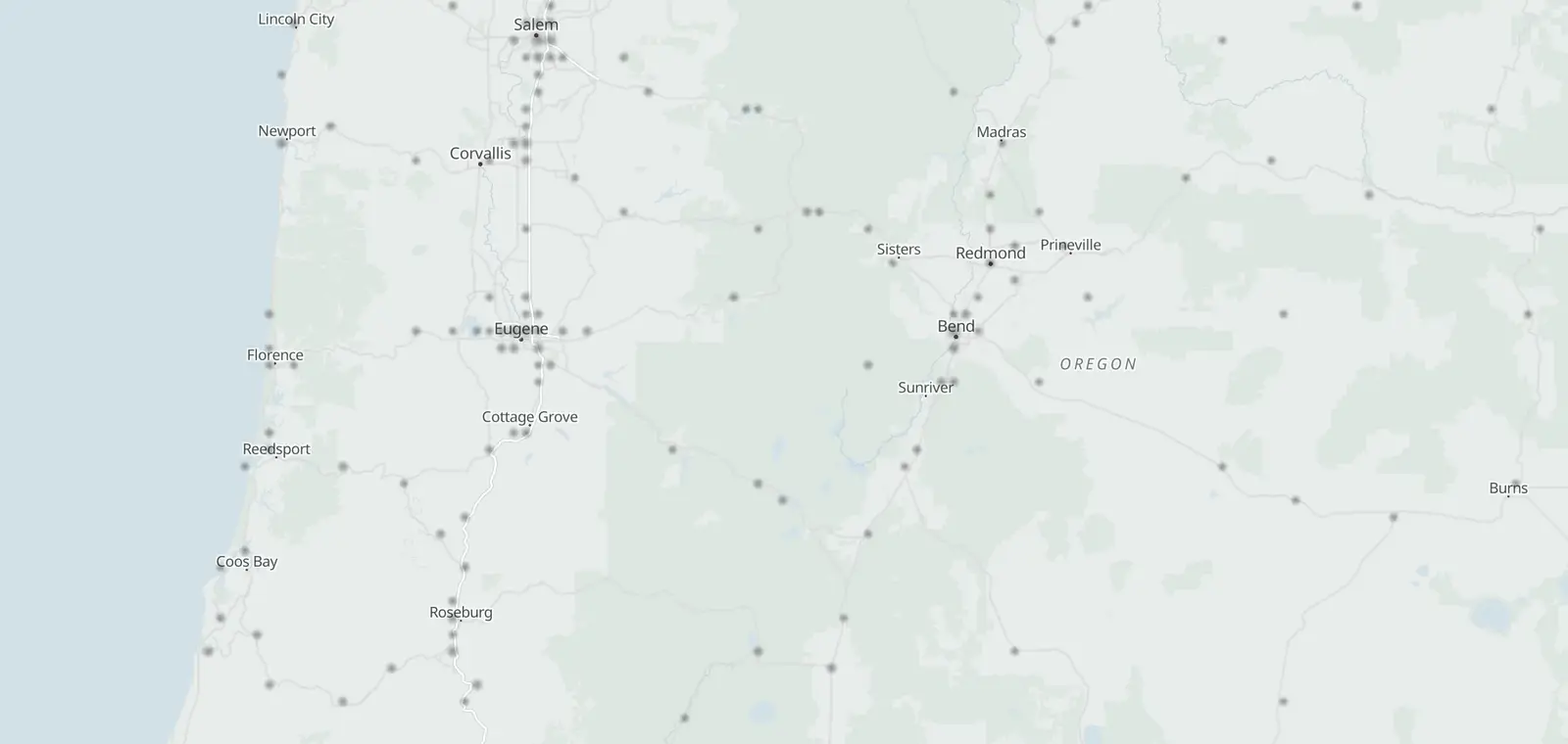
1,159 cameras on the map, 1,149 with a picture.
ODOT TripCheck · © OpenMapTiles © OpenStreetMap contributors
Oregon's road cameras: 1,159 on the state's list, and 1,149 with a current picture. ODOT says most update every 5 minutes. This page lists them by highway, pass and city. Tap a camera to see its picture, with the time ODOT prints on it. Cameras across the state line are left out. Checked November 7, 2026.
Oregon cameras by highway
734 highway cameras on 65 routes: Interstates, then US routes, then Oregon routes. Rows run in road order: north to south on a north–south road, west to east on the others. Tap Show picture to see one.
Interstates
| Place | Direction | Picture |
|---|---|---|
| I-5141 | ||
| Interstate Bridge - Top | ODOT had no current picture for this camera at the last check | |
| Interstate Bridge SB (North End) | ||
| Interstate Bridge NB (Midspan) | ||
| 138 more on I-5: the map · Siskiyou Pass (I-5) cameras, Ashland to the California line · I-5 in Portland | ||
| I-823 | ||
| Umatilla | ||
| Umatilla | ||
| I-84 - Westland Rd. | ||
| I-84102 | ||
| Metro Bldg. | ||
| Grand | ||
| Lloyd Blvd | ||
| 99 more on I-84: the map · I-84 in Portland | ||
| I-1052 | ||
| Country Club | ||
| Coburg Rd | ||
| I-20526 | ||
| Government Island | ||
| Airport Way | ||
| US30BY (Lombard) | ||
| Prescott St. | ||
| Glisan | SB | |
| Stark | ||
| Division | SB | |
| Powell | ||
| Foster | ||
| 92nd | ||
| Johnson Creek | ||
| Sunnyside | ||
| Sunnybrook | ||
| Lawnfield Rd. | ||
| OR212 -224 | ||
| Strawberry | ||
| Gladstone | ||
| Park Place - OR213 | ||
| Prosperity Park Road | ||
| Stafford Road | ||
| I-5 Ramps | ||
| 99E | ||
| OR43 | ||
| Blankenship Road | ||
| Willamette Falls Viewpoint | ||
| 10th West Linn | ||
| I-4056 | ||
| Fremont Bridge (Top of Arch) | ||
| Everett | ||
| SW Alder | ||
| SW Jefferson | ||
| Montgomery | ||
| Fourth | ||
US routes
| Place | Direction | Picture |
|---|---|---|
| US 2030 | ||
| Pioneer Mountain | ||
| Pioneer Mountain | ||
| Dudlee Hill | ||
| Spring Hill Dr | ||
| Spring Hill Dr | ||
| Spring Hill Dr | ||
| Waverly Dr SE | ||
| Waverly Dr SE | ||
| Weldwood Dr | ||
| Sweet Home | ||
| Tombstone | ||
| Santiam Jct | ||
| Santiam Jct | ||
| Santiam Pass | ||
| Santiam Pass | ||
| Camp Sherman MP91.40 | ||
| Sisters | ||
| Cooley Rd | ||
| Bend - Butler Market Rd | ||
| Parkway On-Ramp | ||
| Ward-Hamby Rd | ||
| Horse Ridge | ||
| Hampton | ||
| Buck Creek | ||
| US395 - Riley | ||
| US395 Burns | ||
| Stinking Water Summit | ||
| Stinking Water Summit | ||
| Drinkwater Pass | ||
| Drinkwater Pass | ||
| US 2668 | ||
| MP3.82 | ||
| David Douglas Park | ||
| Quartz Creek | ||
| 65 more on US 26: the map · Mt Hood (US 26 and OR 35) cameras · US 26 in Portland | ||
| US 3015 | ||
| Tongue Point | ||
| Tongue Point | ||
| Bradley Wayside | ||
| Rainier Summit | ||
| Rainier Summit | ||
| Lewis and Clark Bridge | ||
| Lewis and Clark Bridge | ||
| Lewis and Clark Bridge | ||
| Millard Rd | ||
| Millard Rd | ||
| St Johns Bridge Top | ||
| St Johns Bridge | NB | |
| St Johns Bridge | SB | |
| 29th | ||
| Nicolai | ODOT had no current picture for this camera at the last check | |
| US 9510 | ||
| Jordan Valley | ||
| Rome Hill | ||
| Rome Hill | ||
| Burns Jct | ||
| Burns Jct | ||
| Basque Station | ||
| Blue Mtn Pass | ||
| Blue Mtn Pass | ||
| McDermitt | ||
| McDermitt | ||
| US 9746 | ||
| Biggs Jct | ||
| Wasco | ||
| Kent | ||
| 43 more on US 97: the map | ||
| US 10134 | ||
| Astoria Bridge (North Span) | ||
| Astoria Bridge (Center Span) | ||
| Astoria - ODOT District Office | ||
| Harbor St | ||
| Neptune Dr | ||
| Camp Rilea | ||
| Seaside MP 22.50 | SB | |
| Seaside | ||
| Cannon Beach | NB | |
| Lincoln City - Logan Rd | ||
| Lincoln City | ||
| Lincoln City - D River Wayside | ||
| Newport - Yaquina Bay Bridge | S | |
| Newport - Yaquina Bay Bridge | N | |
| Newport - Yaquina Bay Jetty | ||
| Cape Cove | ||
| Cape Cove | ||
| OR126 | S | |
| Gardiner Hill | ||
| Gardiner Hill | ||
| Reedsport | ||
| Reedsport | ||
| McCullough Bridge | ||
| E. Beaver Ln. (Beaver Hill) | SB | |
| E. Beaver Ln (Beaver Hill) | NB | |
| Bullards Bridge | ||
| Bullards Bridge | ||
| OR42S | ||
| OR42S | ||
| Port Orford | ||
| Port Orford Storm | ||
| Gold Beach | ||
| Brookings | ||
| Brookings | ||
| US 1971 | ||
| Tygh Ridge | ||
| US 1996 | ||
| Ringuette St (Grants Pass) | ||
| Ringuette St (Grants Pass) | ||
| Grants Pass | ||
| Grants Pass | ||
| Hayes Hill | ||
| OR46 (Cave Junction) | ||
| US 39510 | ||
| Stanfield Interchange | ||
| Cape Horn | ||
| Cape Horn | ||
| Battle Mountain | ||
| Long Creek | ||
| Canyon City | ||
| Seneca | ||
| Alkali Lake | ||
| Valley Falls - ORE31 | ||
| Lakeview | ||
| US 7303 | ||
| Hatrock | ||
| Rockfall Area | ||
| Rockfall Area | ||
Oregon routes
| Place | Direction | Picture |
|---|---|---|
| OR 31 | ||
| Flora MP 9.4 | ||
| OR 64 | ||
| Olsen Rd | ||
| Fairview | WB | |
| Lees Camp | ||
| Gales Creek Rd | ||
| OR 71 | ||
| Sumpter | ||
| OR 84 | ||
| Brookwood Ave | ||
| Cornelius Pass Rd | ||
| 185th Ave | ||
| Murray Blvd | ||
| OR 117 | ||
| Crockett Rd | ||
| Crockett Rd | ||
| Dry Creek | ||
| Dry Creek | ||
| OR204 | ||
| OR204 | ||
| OR204 | ||
| OR 188 | ||
| Murphy Hill | ||
| Murphy Hill | ||
| OR22 - Valley Junction | ||
| Fulquartz Landing | ||
| 8th St | ||
| Waterfront St | ||
| Wynooski Rd | ||
| Fernwood Rd | ||
| OR 2212 | ||
| Butler Hill | ||
| Butler Hill | ||
| Eola | EB | |
| Eola | WB | |
| Cordon Rd | ||
| Cordon Rd | ||
| OSCI Hill | ||
| OSCI Hill | ||
| Santiam Park | ||
| Santiam Park | ||
| Detroit Ranger Station | ||
| Detroit | ||
| OR 312 | ||
| Silver Lake MP47.3 | ||
| Paisley | ||
| OR 343 | ||
| Peoria Rd | ||
| Columbus | ||
| Columbus | ||
| OR 352 | ||
| Parkdale Maint | ||
| Meadows Dr | ||
| OR 384 | ||
| Scottsburg | ||
| Scottsburg | ||
| Wells Creek | ||
| Elkton | ||
| OR 428 | ||
| Coquille | ||
| Coquille | ||
| OR542 (Powers Jct.) | ||
| OR542 (Powers Jct.) | ||
| Coos County Line | ||
| Coos County Line | ||
| Camas Mountain | ||
| Camas Mountain | ||
| OR 471 | ||
| Stub Stewart Park | ||
| OR 587 | ||
| MP0.86 | ||
| MP0.86 | ||
| Crestview St. | ||
| Salt Creek Tunnel | ||
| Salt Creek Tunnel | ||
| Willamette Pass | ||
| Willamette Pass | ||
| OR 6211 | ||
| Union Creek | ||
| Linn Rd Eagle Point | ||
| Linn Rd Eagle Point | ||
| OR140 (Leigh Way) | ||
| Fowler Dr | ||
| Gregory Rd | ||
| Vilas Rd | ||
| Commerce Dr | ||
| Delta Waters | ||
| Poplar | ||
| Rogue Valley Mall Ent | ||
| OR 661 | ||
| OR140 | ||
| OR 782 | ||
| Folly Farm | ||
| Folly Farm | ||
| OR 826 | ||
| Minam Summit | ||
| Minam Summit | ||
| Minam Big Canyon | ||
| Minam Big Canyon | ||
| Bramlet Rd | ||
| Bramlet Rd | ||
| OR 863 | ||
| Halfway Valley | ||
| Halfway Valley | ||
| Halfway Summit | ODOT had no current picture for this camera at the last check | |
| OR 99E2 | ||
| MP0.42 | ||
| MP0.42 | ||
| OR 99W24 | ||
| Market | ||
| Hamilton | N | |
| Hamilton | S | |
| Brier | ||
| Bertha | ||
| Taylors Ferry | ||
| Capitol | ||
| McDonald | ||
| Durham Rd | ||
| Tualatin Sherwood | ||
| SW Edy Rd | ||
| Meineke Rd | ||
| Sunset Blvd | ||
| Rex Hill | ||
| Rex Hill | ||
| Springbrook Rd | ||
| Home Acres Rd | ||
| Home Acres Rd | ||
| 5th St | ||
| OR18 | ||
| Lafayette Ave | ||
| 2nd St | ||
| 2nd St | ||
| HWY36 Junction City | ||
| OR 12617 | ||
| Cushman | ||
| Walton (Cougar/Badger Pass) | ||
| Walton (Cougar/Badger Pass) | ||
| Territorial Hwy | ||
| Central Rd | ||
| Central Rd | ||
| Green Hill Rd | ||
| 52nd | ||
| 52nd | ||
| Walterville | ||
| Walterville | ||
| McKenzie | ||
| McKenzie | ||
| SW 5th St | ||
| Powell Butte | ||
| Powell Butte | ||
| Harwood MP18.35 | ||
| OR 1272 | ||
| MP3.08 | ||
| MP3.08 | ||
| OR 1322 | ||
| OR132 Delta Hwy Near Valley River | ||
| OR132 Delta Hwy Near Woodfield | ||
| OR 1385 | ||
| Marvin Hill | ||
| Marvin Hill | ||
| Diamond Lake Jct | ||
| OR138 near US97 | ||
| OR138 near US97 | ||
| OR 14010 | ||
| Medford Lake Creek Scales | ||
| Lake of the Woods | ||
| Doak Mountain | ||
| Bly Mtn | ||
| Bly | ||
| Quartz Mountain | ||
| Warner Mtn Summit | ||
| Adel | ||
| Nevada State Line | ||
| Nevada State Line | ||
| OR 2015 | ||
| I-84 WB Onramp | ||
| I-84 EB Onramp | ||
| Weiser | ||
| Adrian | ||
| Adrian | ||
| OR 2032 | ||
| Catherine Creek Summit | ||
| Catherine Creek Summit | ||
| OR 2045 | ||
| Tollgate Sand Shed | ||
| Tollgate | ||
| Spout Springs | ||
| Spout Springs | ||
| Elgin | ||
| OR 2051 | ||
| Frenchglen | ||
| OR 2072 | ||
| OHV Park | ||
| OHV Park | ||
| OR 21313 | ||
| Killingsworth | ||
| Sandy Blvd | ||
| NE Tillamook | ||
| Glisan St | ||
| Washington St | ||
| Division St | ||
| Woodward St | ||
| Powell Blvd | ||
| Powell Blvd | ||
| Foster Rd | ||
| Duke St | ||
| Springwater | ||
| Beavercreek | ||
| OR 2142 | ||
| Silver Ridge | ||
| Silver Creek | ||
| OR 2178 | ||
| Walker | ||
| Tualatin Valley Hwy | ||
| Allen | ||
| Denney | ||
| Hall | ||
| Scholls Ferry Road | ||
| Greenburg | ||
| OR99W | ||
| OR 2181 | ||
| Prindle Hill | ||
| OR 2195 | ||
| Chehalem Mt. | ||
| Chehalem Mt. | ||
| Springbrook Rd | ||
| OR18 | ||
| Woodland Ave | ||
| OR 2212 | ||
| Orchard Heights | ||
| Glen Creek | ||
| OR 2221 | ||
| I-5 NB Ramps | ||
| OR 2248 | ||
| OR224 a Harrison St | ||
| Harmony Rd | ||
| Johnson Rd | ||
| OR213 | ||
| Evelyn St | ||
| 122nd Ave | ||
| 135th Ave | ||
| ORE212 | ||
| OR 2251 | ||
| 30th Ave | ||
| OR 2302 | ||
| OR230 Diamond Lake | ||
| OR230 Diamond Lake | ||
| OR 2383 | ||
| Jacksonville Hill | ||
| Jacksonville Hill | ODOT had no current picture for this camera at the last check | |
| Jacksonville Hill | ||
| OR 2442 | ||
| Ukiah-Hilgard Summit | ||
| Ukiah-Hilgard Summit | ||
| OR 2452 | ||
| Dooley Mtn | ||
| Dooley Mtn | ||
| OR 3311 | ||
| Pendleton MP4.6 | ||
| OR 3702 | ||
| Lone Pine Rd | ||
| Lone Pine Rd | ||
| OR 3801 | ||
| Paulina | ||
| OR 5512 | ||
| Ehlen Rd | ||
| Ehlen Rd | ||
| OR 56911 | ||
| Roosevelt Blvd | ||
| Roosevelt Blvd | ||
| OR126/W 11th | ||
| OR126/W 11th | ||
| Barger Dr | ||
| OR99 | ||
| OR569 Beltline Near NW Expressway | ||
| River Rd. | ||
| River Ave. | ||
| Delta Hwy | ||
| Coburg Rd. | ||
Mountain passes
- Mt Hood (US 26 and OR 35) cameras: Sandy to the OR 216 junction · Chain rules ↗ 20 cameras
- Santiam Pass (US 20 and OR 22) cameras: Sweet Home to Sisters · Chain rules ↗ 12 cameras
- Siskiyou Pass (I-5) cameras, Ashland to the California line: Ashland to the California line · Chain rules ↗ 15 cameras
Willamette Pass (OR 58)
7 cameras on OR 58, in road order: MP0.86, Crestview St., Salt Creek Tunnel and Willamette Pass. Road conditions: the TripCheck map.
| Place | Direction | Picture |
|---|---|---|
| OR 587 | ||
| MP0.86 | ||
| MP0.86 | ||
| Crestview St. | ||
| Salt Creek Tunnel | ||
| Salt Creek Tunnel | ||
| Willamette Pass | ||
| Willamette Pass | ||
Other summits ODOT names
65 cameras at the summits and grades ODOT names on 18 routes, by route.
| Place | Direction | Picture |
|---|---|---|
| I-510 | ||
| Rice Hill | ||
| Rice Hill | ||
| Roberts Mountain | ||
| Roberts Mountain | ||
| Roberts Mountain | ||
| Roberts Mountain | ||
| Stage Road Pass | ||
| Stage Road Pass | ||
| Sexton Summit | ||
| Sexton Summit | ||
| I-8418 | ||
| Cabbage Hill | ||
| Cabbage Hill | ||
| Cabbage Hill MP222.35 | ||
| Cabbage Hill MP222.35 | ||
| Cabbage Hill MP220.83 | ||
| Cabbage Hill MP220.83 | ||
| Cabbage Hill MP221.45 | ||
| Cabbage Hill MP221.45 | ||
| Cabbage Hill MP223.52 | ||
| Cabbage Hill MP223.52 | ||
| Cabbage Hill - Deadman Pass | ||
| Deadman Pass | ||
| Deadman Pass | ||
| Meacham | ||
| Meacham | ||
| Meacham | WB | |
| Meacham | EB | |
| Ladd Creek Summit | ||
| US 206 | ||
| Pioneer Mountain | ||
| Pioneer Mountain | ||
| Stinking Water Summit | ||
| Stinking Water Summit | ||
| Drinkwater Pass | ||
| Drinkwater Pass | ||
| US 265 | ||
| Ochoco Summit | ||
| Keyes Summit | ||
| Eldorado Summit | ||
| Eldorado Summit | ||
| Brogan Hill | ||
| US 302 | ||
| Rainier Summit | ||
| Rainier Summit | ||
| US 952 | ||
| Blue Mtn Pass | ||
| Blue Mtn Pass | ||
| US 972 | ||
| Spring Creek (Top of Grade) | ||
| Spring Creek (Bottom of Grade) | ||
| US 1991 | ||
| Hayes Hill | ||
| US 3951 | ||
| Battle Mountain | ||
| OR 422 | ||
| Camas Mountain | ||
| Camas Mountain | ||
| OR 822 | ||
| Minam Summit | ||
| Minam Summit | ||
| OR 861 | ||
| Halfway Summit | ODOT had no current picture for this camera at the last check | |
| OR 1262 | ||
| Walton (Cougar/Badger Pass) | ||
| Walton (Cougar/Badger Pass) | ||
| OR 1404 | ||
| Doak Mountain | ||
| Bly Mtn | ||
| Quartz Mountain | ||
| Warner Mtn Summit | ||
| OR 2032 | ||
| Catherine Creek Summit | ||
| Catherine Creek Summit | ||
| OR 2041 | ||
| Tollgate | ||
| OR 2442 | ||
| Ukiah-Hilgard Summit | ||
| Ukiah-Hilgard Summit | ||
| OR 2452 | ||
| Dooley Mtn | ||
| Dooley Mtn | ||
Chain rules, road conditions and closures
ODOT posts closures, crashes and road conditions on the TripCheck map, with its road conditions report and Winter Road Maintenance pages. In winter, the rules are on Minimum Chain Requirements, Chain Law and Traction Tires. By phone, dial 511 in Oregon (800-977-6368 if your carrier does not support 511, 503-588-2941 from outside Oregon). Drive the posted limit.
Cameras by city
112 places in Oregon have a camera inside the city line (US Census Bureau), most first. A place opens the camera map there.
City and county street cameras
ODOT also shows 425 street cameras that cities and counties run. These partner cameras are shown on ODOT TripCheck. Portland's are on the Portland page.
- Clackamas County 124 cameras
- Washington County 124 cameras
- Portland (PBOT) 112 cameras
- Salem 22 cameras
- Eugene 16 cameras
- Jackson County 2 cameras
- Coburg 1 camera
- Crook County 1 camera
- Klamath Falls 1 camera
- No owner in ODOT’s camera name 22 cameras
About ODOT's TripCheck cameras
ODOT's cameras post still pictures, not video. ODOT says: “Most of the cameras update every 5 minutes. Rural camera may take a little longer depending on their network connection.” and “ODOT does not save camera images.” At night TripCheck shows each camera's Last Daylight Image.
ODOT prints the update time on each picture. Highway cameras also carry the milepost and elevation, and most rural ones a direction letter; metro cameras pan and tilt.
Some cameras belong to cities and counties. ODOT shows them on TripCheck.
The locations come from the Oregon Office of Emergency Management's layer of ODOT's TripCheck cameras, refreshed daily. CamsAhead reads it daily, last November 7, 2026, and checks each picture's headers once a day: a picture that is not current is not counted. A picture loads from tripcheck.com when you tap it; CamsAhead keeps none.
ODOT also shows cameras across the state line in Washington, Idaho and California. They are not listed here; the California side is on the Caltrans page. These cameras give no tickets: see cameras in Oregon. TripCheck is the official source, and its Custom Cameras page saves your own set.
Oregon traffic camera questions
Where can I see Oregon's traffic cameras?
On this page, by highway: tap Show picture on any camera to see its picture from TripCheck. ODOT's own site is TripCheck, the official source, with its camera report by region.
How often do ODOT cameras update?
ODOT says: “Most of the cameras update every 5 minutes. Rural camera may take a little longer depending on their network connection.” Each picture carries the time ODOT printed on it; the time under a picture here is when you opened it.
Are these cameras video?
No. They post still pictures. ODOT says: “ODOT does not save camera images.” At night TripCheck keeps one Last Daylight Image per camera (TripCheck FAQ).
Which way is the camera looking?
ODOT says: “The cameras outside the metro areas have a direction indicator located in the right hand corner above the camera image. These cameras are always looking in the same direction.” The list shows a direction where ODOT's camera name carries one.
Which cameras cover Mt Hood, Santiam Pass and Siskiyou Pass?
Mt Hood (20), Santiam Pass (12) and Siskiyou Pass (15). Willamette Pass on OR 58 is below.
Where are the chain and traction rules?
On TripCheck: Minimum Chain Requirements, Chain Law and Traction Tires. See chain rules and road conditions.
Why are the Vancouver, Idaho and California cameras not here?
ODOT also shows partner cameras across the state line on TripCheck, from WSDOT, ITD and Caltrans. This page lists Oregon's. The California side is on the Caltrans page.
Are these cameras used for tickets?
No. They show the road. Oregon's speed and red light cameras are on cameras in Oregon; Portland's safety cameras are linked from the Portland page.
Is this TripCheck?
No. CamsAhead lists ODOT's TripCheck cameras on one page. TripCheck is the official source.
Know when cameras in Oregon change.
Free email alerts for cameras on your routes that start issuing tickets. One summary email a month.
- In your monthly summary: the day a camera near you starts issuing tickets
- New cameras mapped or reported near you
- Your street, your distance, the camera types you pick
557 cameras listed or mapped in Oregon so far.
Sources and updates
How this page was made: CamsAhead writes each page type once, then fills it with this place's data from the sources below.
- Oregon Office of Emergency Management: “Oregon Traffic Cameras” ArcGIS layer (data courtesy of ODOT's TripCheck), refreshed daily by OEM; read November 7, 2026. Cameras ODOT shows across the state line are left out.
- ODOT TripCheck: Pictures: via ODOT TripCheck, loaded from tripcheck.com when you tap one; CamsAhead stores none. A daily header check marks a picture that is not current (10 at the last check). Credits: Camera courtesy of ODOT, PBOT, Clackamas County, Washington County and the other owners as printed on each picture. Boundaries: US Census Bureau.
How CamsAhead counts cameras · Report a problem · Report a camera