
 CamsAhead.com
Cameras in Los Angeles
No city red light cameras. Of 125 speed cameras, 26 already send warnings; none send tickets yet.
Plate readers © OpenStreetMap contributors · Caltrans (CC BY) · © OpenMapTiles
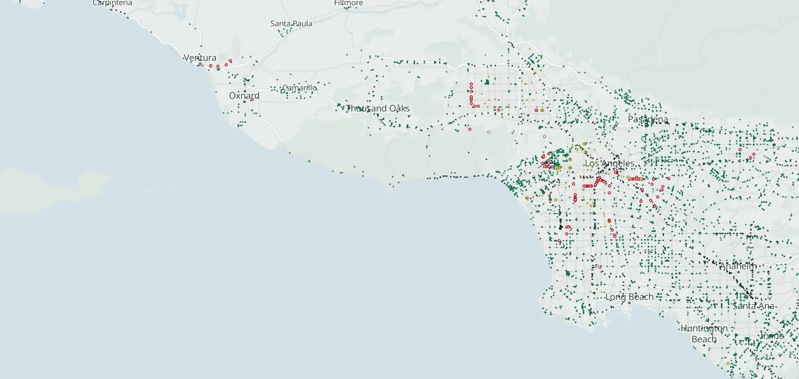
Los Angeles, by camera type.
Los Angeles: 544 plate readers mapped. Nearby: Beverly Hills 186, West Hollywood 56, Culver City 87 and Santa Monica 90.
Speed cameras in Los Angeles
26 listed "Warning Live", 99 under construction. Warning notices began Oct 26, 2026. Tickets are expected from about Dec 25, 2026 for the first cameras.
19 more speed or red light cameras are on the map, counted apart from official lists.
The enabling law:
AB 645, California Vehicle Code §22425(a)
Red light cameras in Los Angeles
Los Angeles ended its own red light cameras in 2011. Nearby, Culver City lists 12 intersections.
Beverly Hills, Commerce, Covina, Hawthorne and Montebello run programs too. Their intersections come from public records, so they are marked unverified.
Inside the city, public records from 2020 and 2021 list LA Metro cameras at 47 rail crossings and busway intersections. They are marked unverified too.
License plate readers in Los Angeles
544 plate readers are on the map in Los Angeles, and 380 of them carry the Flock Safety tag. Most don't say who runs them.
First-mapped dates here run from Nov 23, 2024 to Nov 7, 2026. 383 of the 544 were first mapped in 2026, with 66 in June alone.
The EFF's Atlas of Surveillance lists 2 agencies based in Los Angeles that use plate readers, among them Los Angeles Police Department.
Flock cameras in Los Angeles Flock cameras in NorthridgeFlock cameras in Pacific PalisadesFlock cameras in Westwood
Who can search plate reads in Los Angeles
EyesOnFlock lists no transparency portal for the Los Angeles Police Department (Oct 14, 2026). It posts no sharing list, so who can search reads from its cameras is not stated. The sharing lists of 125 agencies name it, so it can search their reads.
Los Angeles Police Department
- Agencies on its posted sharing list
- Not stated
- Keeps each read for
- Not stated
- Agencies whose reads it can search
- 125
No transparency portal listed, Oct 14, 2026 · See its sharing lists, as of Oct 14, 2026
Get one summary email a month on new plate readers in Los Angeles
Portal figures and sharing lists: EyesOnFlock (CC BY-SA 4.0), from Flock Safety transparency portals.
Traffic cameras in Los Angeles
191 in service. Freeways and state highways only.
Los Angeles neighborhoods
139 neighborhoods, busiest first. Every one has a page. Unincorporated LA County →
Red light: some unverified (public records).
No neighborhood called “”. Try the search above.
Includes Larchmont, Fairfax and Beverly Grove
Includes Chesterfield Square and Vermont-Slauson
Includes Sepulveda Basin
Includes Hollywood Hills West
Includes Chatsworth Reservoir
Includes Sawtelle
Includes Griffith Park
Includes Broadway-Manchester
Includes Broadway-Manchester
Includes Montecito Heights
Includes Pico-Robertson
Includes Hollywood Hills West
Includes Sawtelle
Includes Cypress Park
Includes Beverly Grove
Includes Historic South-Central
Includes Montecito Heights
Includes Windsor Square
Includes Mid-Wilshire
Includes Cypress Park
Includes Hansen Dam
Includes Arlington Heights
Speed camera pages by neighborhood
Camera tickets in Los Angeles
Know when cameras in Los Angeles change.
Free email alerts for cameras on your routes that start issuing tickets. One summary email a month.
- In your monthly summary: the day a camera near you starts issuing tickets
- New cameras mapped or reported near you
- What plate readers keep, and who runs them
- Your street, your distance, the camera types you pick
156,883 cameras listed or mapped so far.
Sources and updates
How this page was made: CamsAhead writes each page type once, then fills it with this place's data from the sources below.
- LADOT: speed camera list, checked Nov 7, 2026
- OpenStreetMap contributors: plate readers, speed and red light cameras, data as of Nov 7, 2026; ODbL 1.0
- EFF Atlas of Surveillance: agencies that use plate readers, data as of Aug 2026; CC BY 4.0
- Caltrans CWWP2: camera list, updated daily, last Nov 7, 2026; CC BY
- US Census Bureau: city boundary (cartographic file 2025)
Plate reader points are mapped by OpenStreetMap volunteers (data as of November 7, 2026).
How CamsAhead counts cameras · Report a problem · Report a camera