
 CamsAhead.com
Cameras in Unincorporated Angeles National Forest
Includes Tujunga Canyons
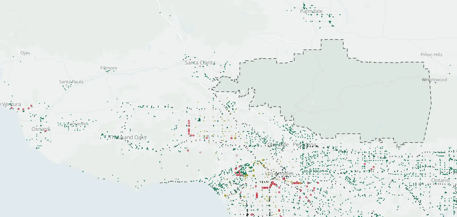
1 mapped plate reader in Unincorporated Angeles National Forest.
Plate readers © OpenStreetMap contributors · Caltrans (CC BY) · © OpenMapTiles
What is inside Unincorporated Angeles National Forest, by camera type.
Unincorporated Angeles National Forest: 1 camera listed or mapped. Nearby: Monrovia 30, Duarte 11, Altadena 67 and Bradbury 1.
Speed cameras in Unincorporated Angeles National Forest
None inside Unincorporated Angeles National Forest. The nearest is on Foothill Blvd (7-3), 1.6 mi outside the boundary.
Red light cameras in Unincorporated Angeles National Forest
No red light camera program is listed here.
License plate readers in Unincorporated Angeles National Forest
1 plate reader is on the map inside Unincorporated Angeles National Forest. 15 more are just outside.
License plate readers by maker →
| Where | Maker tag and operator | Facing | First mapped |
|---|---|---|---|
| Unincorporated Angeles National Forest Show on map | Maker not listed yet Run by: Santa Clarita | Faces southeast (as mapped) | Sep 22, 2025 |
What the plate readers in Unincorporated Angeles National Forest keep
- Records
- The plate of each car that passes, with the time and place. Often a photo of the car.
- Run by
- Tagged ones include Santa Clarita (1).
- Kept for
- Not published on the map.
- Who sees it
- Whoever runs it, and those it shares with. In California, a public agency may share only with other public agencies in the state.
- How to ask
- Read the operator's policy. California requires one. Or ask the city for its records.
Traffic cameras in Unincorporated Angeles National Forest
None inside. Nearest: I-5 at Rte 5/14 Interchange, 0.1 mi outside.
Cameras just outside Unincorporated Angeles National Forest
Just outside the boundary: 15 plate readers and 4 traffic cameras.
- Plate reader · Placerita Canyon 100 ft
- Plate reader · Placerita Canyon 100 ft
- Plate reader · Santa Clarita 400 ft
- Plate reader · Santa Clarita 0.1 mi
- Traffic camera · I-5 North at Rte 5/14 Interchange 0.1 mi
- Traffic camera · SR-14 South at Newhall Ave 0.4 mi
- Traffic camera · I-210 West at Christy Ave 0.5 mi
- Traffic camera · I-5 South, north of Route 14 0.5 mi
The closest 4 of each type. See them all on the map.
Areas near Unincorporated Angeles National Forest
Also near Unincorporated Angeles National Forest: Littlerock/Juniper Hills · Kinneloa Mesa · Sierra Madre
Camera tickets near Unincorporated Angeles National Forest
No speed camera program is listed here. The nearest is in Los Angeles: fines and how to respond.
Know when cameras in Unincorporated Angeles National Forest change.
Free email alerts for cameras on your routes that start issuing tickets. One summary email a month.
- In your monthly summary: the day a camera near you starts issuing tickets
- New cameras mapped or reported near you
- What plate readers keep, and who runs them
- Your street, your distance, the camera types you pick
156,883 cameras listed or mapped so far.
Sources and updates
How this page was made: CamsAhead writes each page type once, then fills it with this place's data from the sources below.
- LADOT: speed camera list, checked Nov 7, 2026
- OpenStreetMap contributors: plate readers (surveillance:type=ALPR), data as of Nov 7, 2026; ODbL 1.0
- Caltrans CWWP2: Districts 6 and 7 camera list, updated daily, last Nov 7, 2026; CC BY
- California Civil Code §1798.90.51: the use and privacy policy rule for plate readers
- California Civil Code §1798.90.55: the rule on who a public agency may share reads with
Plate reader points are mapped by OpenStreetMap volunteers (data as of November 7, 2026).
How CamsAhead counts cameras · Report a problem · Report a camera