
CamsAhead

Near me

Near me
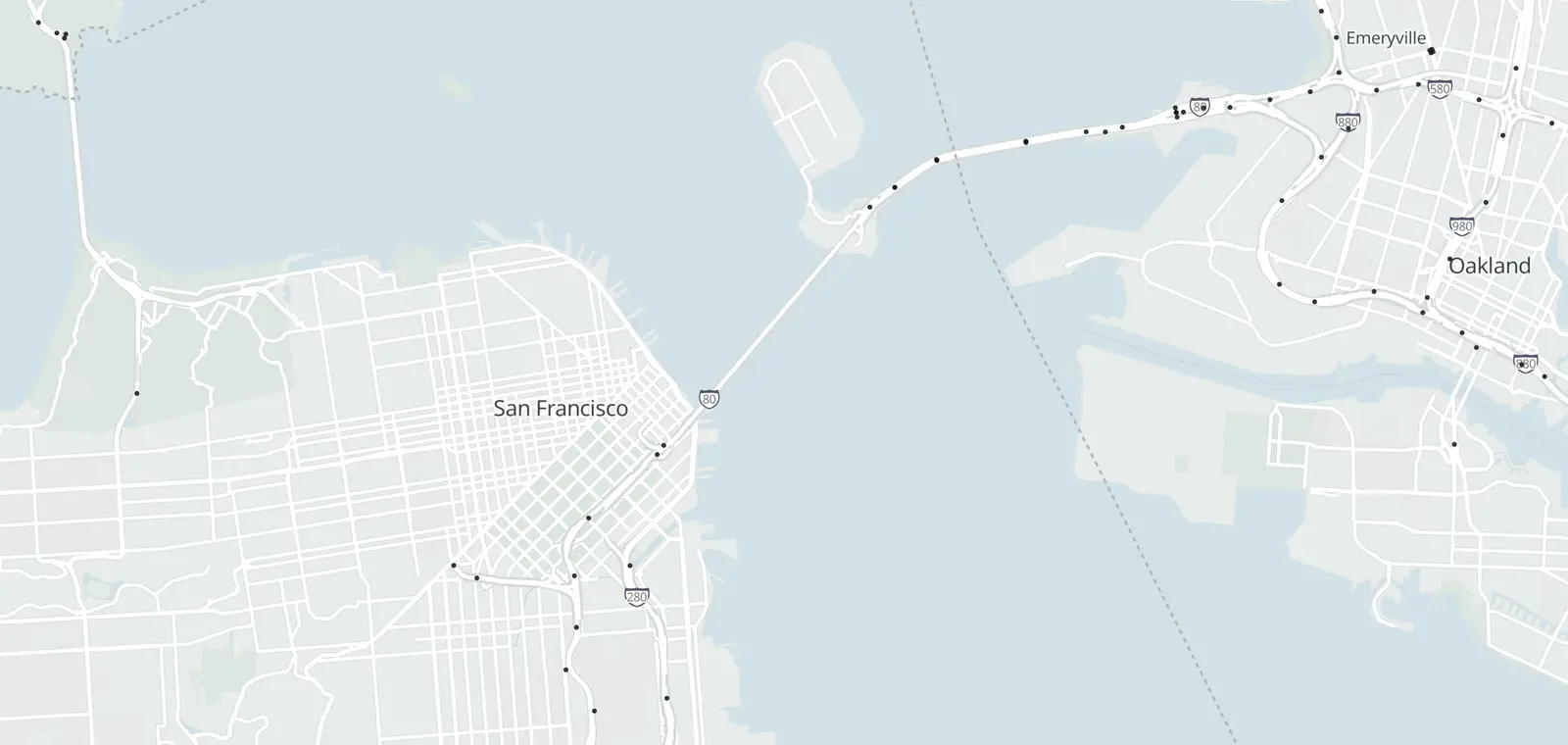
Map of 24 Caltrans traffic cameras on Bay Bridge
In California Traffic cameras 24 Open map
Open map

Bay Bridge (I-80) cameras

24 Caltrans cameras, 24 in service.

Checked

© OpenStreetMap contributors · © OpenMapTiles

Caltrans lists 24 traffic cameras on I-80 across the Bay Bridge, from San Francisco to Emeryville. 24 report in service, and each one links to its image on Caltrans. The list is updated daily, last November 7, 2026. This is the bridge between San Francisco and Oakland, not the Chesapeake Bay Bridge in Maryland.

Bay Bridge cameras, San Francisco to Emeryville

The cameras start in San Francisco and cross the bridge by Yerba Buena Island. Past the toll plaza, they end in Emeryville. Each list runs by county, then postmile, as Caltrans tags them.

San Francisco County · 9Alameda County · 15
Route, direction and placeStatusPicture
I-80 Eastbound 11
Near San Francisco · postmile 4.09 In service Road picture ↗
Near San Francisco · postmile 4.66 In service Road picture ↗
Near San Francisco · postmile 5.48 In service Road picture ↗
Near San Francisco · postmile 8.7 In service Road picture ↗
Near San Francisco · postmile 0.57 In service Road picture ↗
Near Oakland · postmile 1.06 In service Road picture ↗
Near Oakland · postmile 1.21 In service Road picture ↗
Near Oakland · postmile 1.79 In service Road picture ↗
Near Oakland · postmile 2.24 In service Road picture ↗
Near Oakland · postmile 2.56 In service Road picture ↗
Near Emeryville · postmile 3.79 In service Road picture ↗
I-80 Median 2
Near San Francisco · postmile 8.3 In service Road picture ↗
I-80 Westbound 11
Near San Francisco · postmile 5.56 In service Road picture ↗
Near San Francisco · postmile 8.05 In service Road picture ↗
Near San Francisco · postmile 8.7 In service Road picture ↗
Near San Francisco · postmile 0.57 In service Road picture ↗
Near Oakland · postmile 1.35 In service Road picture ↗
Near Oakland · postmile 1.79 In service Road picture ↗
Near Oakland · postmile 1.8 In service Road picture ↗
Near Oakland · postmile 1.85 In service Road picture ↗
Near Oakland · postmile 2.02 In service Road picture ↗
Near Emeryville · postmile 3.64 In service Road picture ↗

See the Bay Bridge cameras on the map

Nearby corridors

Statewide: Caltrans cameras by route and county. Other states: traffic cameras by state.

Road conditions on Bay Bridge

Caltrans posts chain controls, closures, freeway sign messages and CHP incidents on QuickMap and on its I-80 conditions page. Drive the posted limit.

Bay Bridge camera questions

Is this the Chesapeake Bay Bridge?

No. This page is about the Bay Bridge between San Francisco and Oakland, on I-80 in California. The Chesapeake Bay Bridge is in Maryland, run by the MDTA. It is a different bridge, with its own cameras.

Is there a way to see traffic camera footage?

Not past footage. Caltrans says: “Caltrans traffic camera video footage and still images are neither retained nor archived.” Each camera on this page links to its image on the Caltrans site.

Can I get a speeding ticket from a traffic camera?

No. These Caltrans cameras show the road. They are not speed or red light cameras, and they issue no tickets. Speed cameras have their own pages, such as California speed cameras.

Is there an app that tells you where traffic cameras are?

Yes. The CamsAhead app puts these traffic cameras on a map, with speed, red light and plate reader cameras.

How do I view traffic cameras on Google Maps?

Google Maps does not show Caltrans camera images. Caltrans QuickMap does, and so does this page: each row links to the camera's picture on Caltrans.

Camera alerts

Know when cameras in California change.

Free email alerts for cameras on your routes that start issuing tickets. One summary email a month.

  • In your monthly summary: the day a camera near you starts issuing tickets
  • New cameras mapped or reported near you
  • Your street, your distance, the camera types you pick

25,611 cameras listed or mapped in California so far.

How camera alerts work

Pick a place

Sample place: Mar Vista, Los Angeles, 3 mi around. Pick your own place in California or tap Near me.

Sources and updates

How this page was made: CamsAhead writes each page type once, then fills it with this place's data from the sources below.

  • Caltrans CWWP2: cctvStatus feeds for District 4, updated daily, last Nov 7, 2026; CC BY. Camera images are not stored.

How CamsAhead counts cameras · Report a problem · Report a camera

Add CamsAhead to your Home Screen Open in Safari to install Drive works best from your Home Screen Open in Safari to add it to your Home Screen

It opens straight to the map.

This app’s built-in browser can’t add CamsAhead to your Home Screen.

From your Home Screen, CamsAhead opens full screen with one tap. It keeps the screen on while you drive, where your phone allows it.

  1. Tap Share
    In Safari’s toolbar, or in its ⋯ menu.
  2. Tap Share
    In your browser’s address bar or menu.
  3. Open this page in Safari
    Look for “Open in Safari” or “Open in browser” in this app’s menu, or copy the link.
  4. Copy the link, then paste it in Safari
    Or type CamsAhead.com in Safari.
  5. In Safari, tap Share, then Add to Home Screen
  6. Tap Add to Home Screen
    Scroll down the list if you don’t see it.
  7. Open the ⋮ menu
    Then tap “Add to Home screen” or “Install app”.
  8. Tap Add, then open CamsAhead from your Home Screen. Tap Install, then open CamsAhead from your Home Screen.

Don’t see Add to Home Screen? Open this page in Safari.

Or tap Share in this browser, then Add to Home Screen.

Alerts work while CamsAhead is open on screen, from the Home Screen or the browser. If the screen locks or you switch apps, they stop.

DriveBetaReport a problem